File:Kellas diagram for conference book.png
Revision as of 05:52, 2 June 2010 by Walkerma (talk | contribs) (Map of main conference area, in the Kellas corridor at SUNY Potsdam. Category:Maps)
Size of this preview: 776 × 599 pixels. Other resolution: 2,200 × 1,699 pixels.
Original file (2,200 × 1,699 pixels, file size: 48 KB, MIME type: image/png)
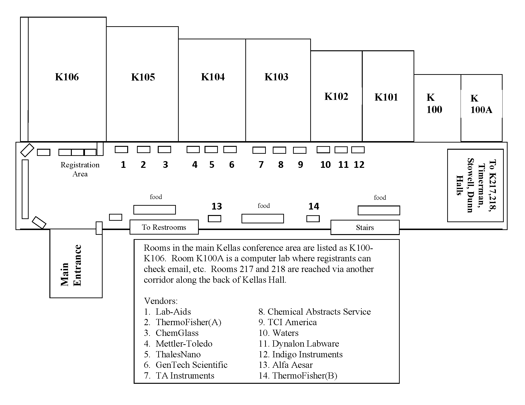
Map of main conference area, in the Kellas corridor at SUNY Potsdam.
File history
Click on a date/time to view the file as it appeared at that time.
| Date/Time | Thumbnail | Dimensions | User | Comment | |
|---|---|---|---|---|---|
| current | 05:52, 2 June 2010 | | 2,200 × 1,699 (48 KB) | Walkerma (talk | contribs) | Map of main conference area, in the Kellas corridor at SUNY Potsdam. Category:Maps |
- You cannot overwrite this file.
File usage
The following page links to this file: